Featured
- Get link
- X
- Other Apps
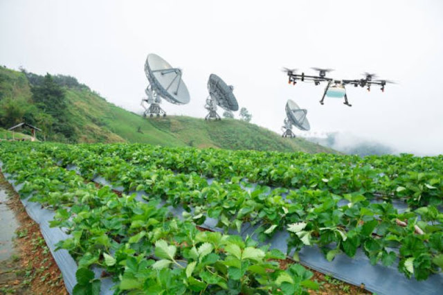
Space technology has enabled satellite-based Earth remote sensing for precision agriculture
Space technology has enabled satellite-based Earth remote sensing for precision agriculture
Space technology has ushered in a new era of precision
agriculture through satellite-based Earth remote sensing. By leveraging the
capabilities of satellites orbiting our planet, farmers and agricultural
experts can gather critical data on crops, soil, weather, and other variables
with unprecedented accuracy. This wealth of information empowers
decision-making, enhances resource management, and contributes to the
sustainability of agricultural practices. Satellite-based remote sensing is
transforming agriculture from a labor-intensive endeavor into a data-driven
science, with the potential to revolutionize global food production and address
the challenges of a growing inhabitants and a changing climate.
Precision agriculture aims to optimize crop yields while
minimizing inputs such as water, fertilizers, and pesticides. Satellite-based
remote sensing plays a central role in achieving this goal by providing
real-time information about the condition of crops and the environment they
grow in. Satellite sensors capture data across various wavelengths, including
visible, infrared, and microwave, allowing for detailed analysis of factors like
plant health, moisture levels, and soil composition.
One of the key advantages of satellite-based remote sensing
is its ability to cover large areas quickly and efficiently. Satellites
orbiting the Earth can collect data from vast agricultural landscapes,
providing a comprehensive view of crop conditions on a regional, national, or
even global scale. This data is then processed to generate detailed maps that
highlight variations in crop health, soil moisture, and nutrient levels across
fields.
Satellite imagery provides valuable insights into plant
health through a technique known as vegetation index analysis. By measuring the
reflectance of light from vegetation in different wavelengths, scientists can
assess the vitality of crops and detect signs of stress, disease, or nutrient
deficiencies. This information enables farmers to target specific areas that
require intervention, such as adjusting irrigation or applying fertilizers only
where they are needed. By minimizing resource waste and reducing the environmental
impact of farming practices, precision agriculture contributes to sustainable
land use.
Weather is a critical factor in agriculture, and
satellite-based remote sensing offers real-time monitoring of weather patterns
that impact crop growth. Data on temperature, humidity, wind, and precipitation
collected from satellites provide valuable information for predicting weather
events and mitigating risks associated with extreme conditions. This
information is especially vital for crop management decisions, helping farmers
protect their yields from frost, drought, and other weather-related challenges.
Satellite-based remote sensing also supports the management
of water resources, a crucial consideration for agricultural sustainability. By
monitoring soil moisture levels and tracking water usage, farmers can optimize
irrigation practices and ensure that crops receive the right amount of water.
This not only conserves water but also enhances crop quality and reduces energy
costs associated with irrigation systems.
Furthermore, satellite technology assists in crop yield
forecasting. By monitoring the growth patterns of crops, estimating biomass,
and analyzing historical data, experts can make informed predictions about
future harvests. This information is invaluable for supply chain management,
helping governments and agribusinesses anticipate food supply and demand and
make strategic decisions about distribution and pricing.
Satellite-based remote sensing is not limited to large-scale
industrial agriculture. It has the potential to benefit smallholder farmers in
developing countries as well. With the increasing availability of affordable
satellite data and user-friendly platforms, small-scale farmers can access
information about their fields and make informed decisions to improve
productivity and income. This democratization of agricultural information can
contribute to poverty reduction and food security in regions where farming is a
primary livelihood.
While the benefits of satellite-based remote sensing for
precision agriculture are substantial, challenges remain. One challenge is data
interpretation and integration. The vast amount of data collected by satellites
needs to be processed, analyzed, and translated into actionable insights for
farmers. User-friendly platforms and tools are being developed to bridge this
gap, enabling farmers to make sense of the complex data and apply it to their
practices effectively.
Another challenge is the cost of satellite imagery and data.
While technology advancements have reduced the cost of satellite missions,
accessing high-resolution and timely data can still be a financial barrier,
particularly for smallholder farmers. Initiatives are underway to make
satellite data more affordable and accessible to farmers around the world,
democratizing the benefits of precision agriculture.
In conclusion, satellite-based Earth remote sensing is
transforming agriculture by ushering in the era of precision farming. By
providing detailed, real-time information about crops, soil, weather, and more,
satellites empower farmers to make data-driven decisions that optimize
productivity, conserve resources, and enhance sustainability. The global reach
of satellite technology means that precision agriculture has the potential to
improve food production across diverse regions and scale up to address the
challenges posed by a growing population and a changing climate. As technology
continues to evolve, satellite-based remote sensing will play an increasingly
pivotal role in shaping the future of agriculture, ensuring that the world can
feed itself while minimizing environmental impact.
- Get link
- X
- Other Apps
Popular Posts
Transformer Protection & Transformer Protection Circuits(1)
- Get link
- X
- Other Apps


Comments
Post a Comment